Our Products
We map a wide range of facilities including, but not limited to: industrial manufactures, individual schools and school districts, office buildings and hotels.
All of our products comply with OSHA regulations in regards to egress. We pride ourselves with producing the finest Safety Maps in the industry and are happy to customize our products to your needs.
You can browse through our products below, or use the navigation to the right to jump to a specific product.
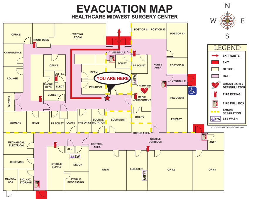
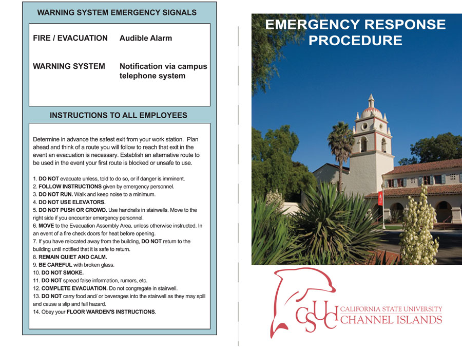
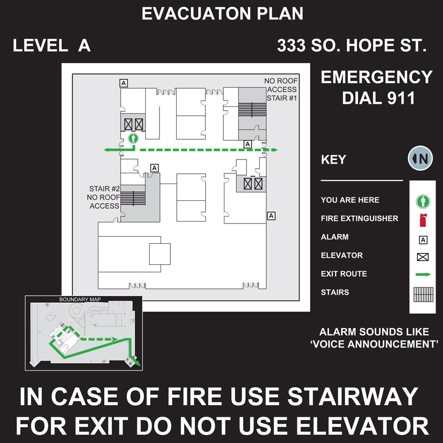
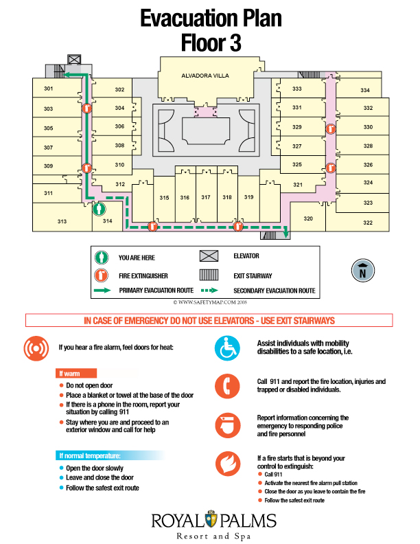
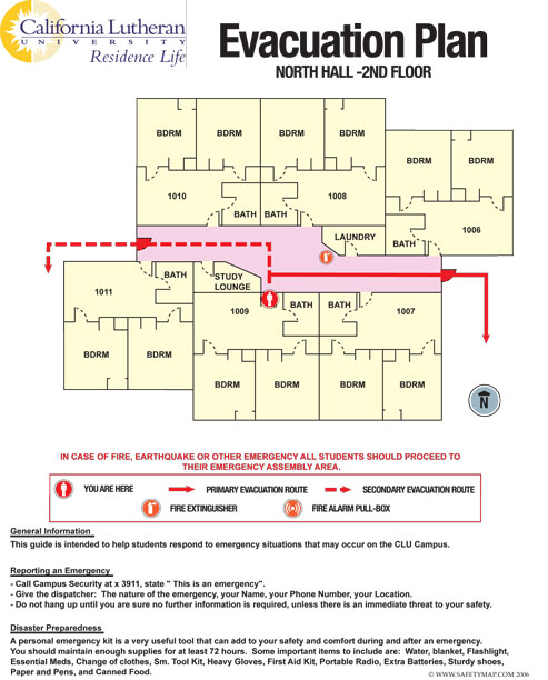
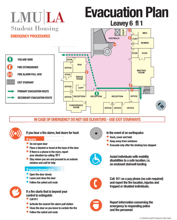
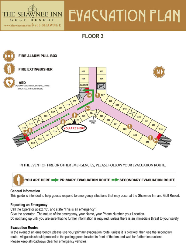
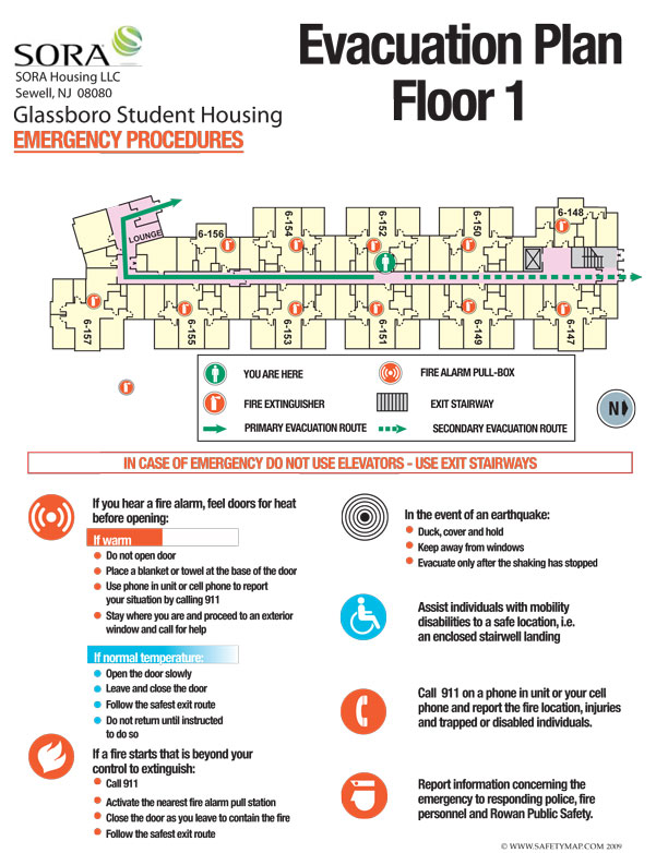
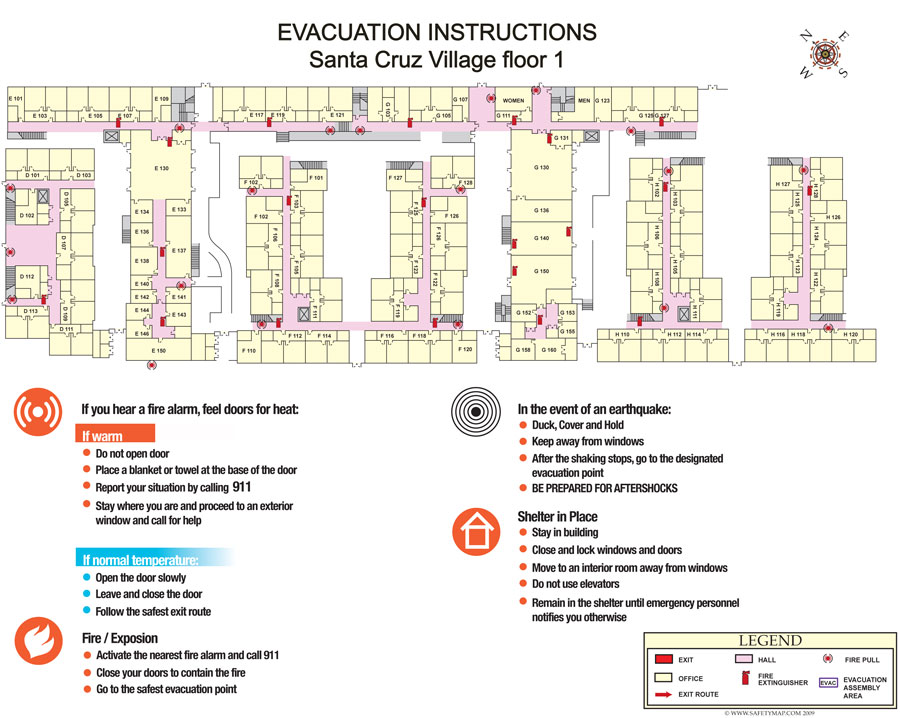
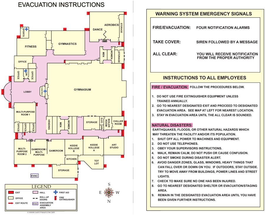
Evacuation MapsUsing your existing floor plan we will create an easy to read map that can be customized to your specifications. This would be displayed throughout your facility to show the closest exits to be used in an emergency. Icons are added to show all hazards and emergency response equipment. Bright red directional arrows point you to the nearest exit. Large You Are Here bubble identifies your viewing location. » Get Estimate |
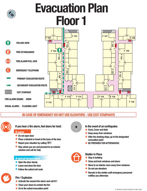
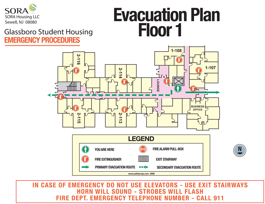
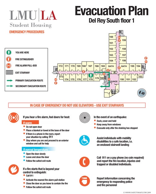
Door MapsEvacuation Plans are required to be posted onto the backs of all doors for the safety of transient and permanent occupants. Our Door Maps show clear evacuation routes from each room along with instruction on what to do in case of an emergency. Fire extinguisher and fire pull station icons can be included to increase their visibility and use. These maps are customized to show the needed information that you would like to convey for the safety of your residence hall or hotel room occupants. » Get Estimate |
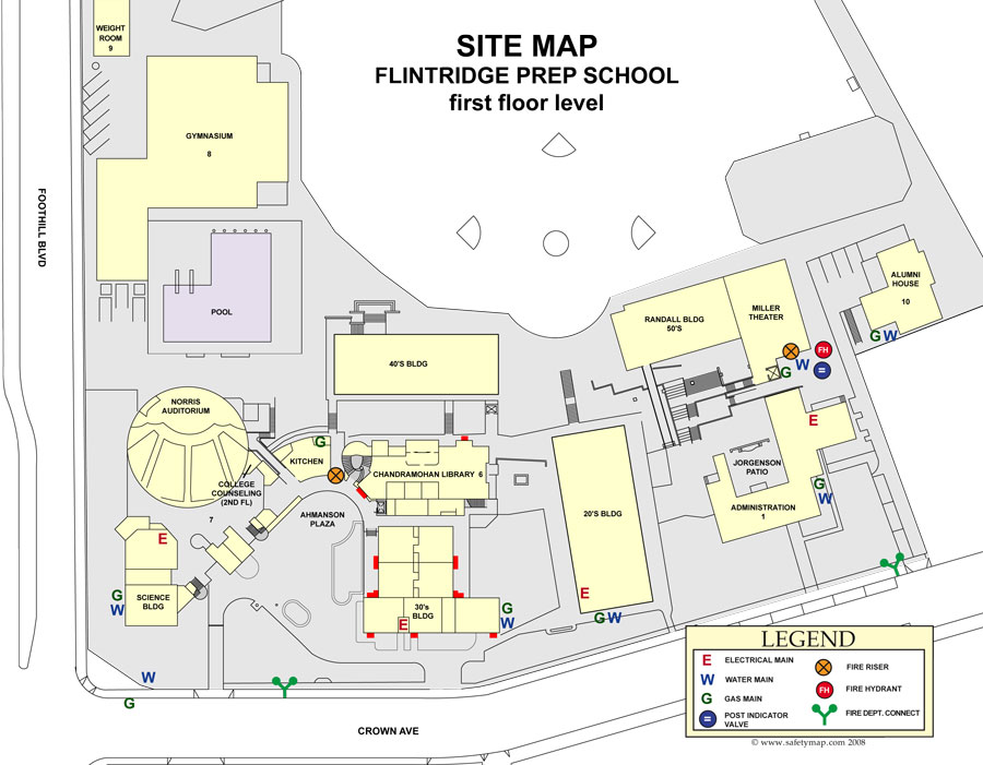
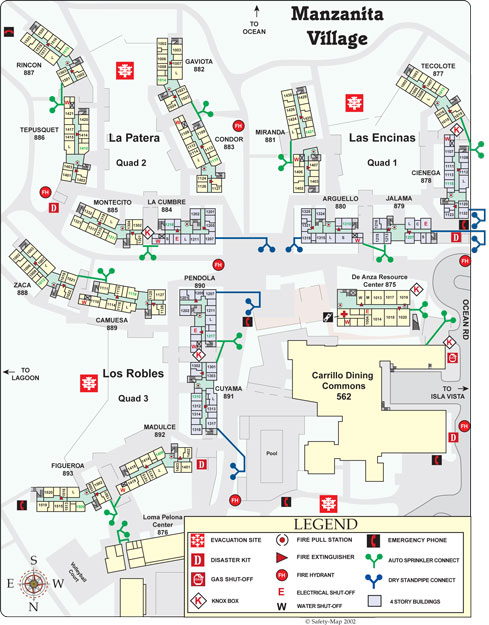
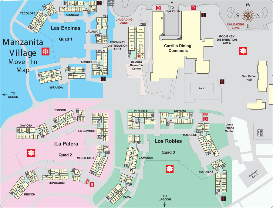
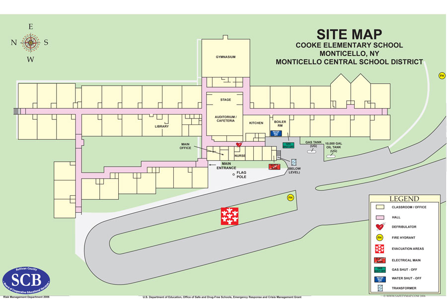
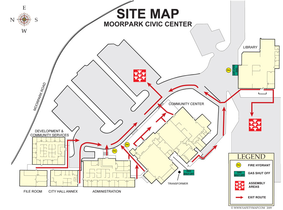
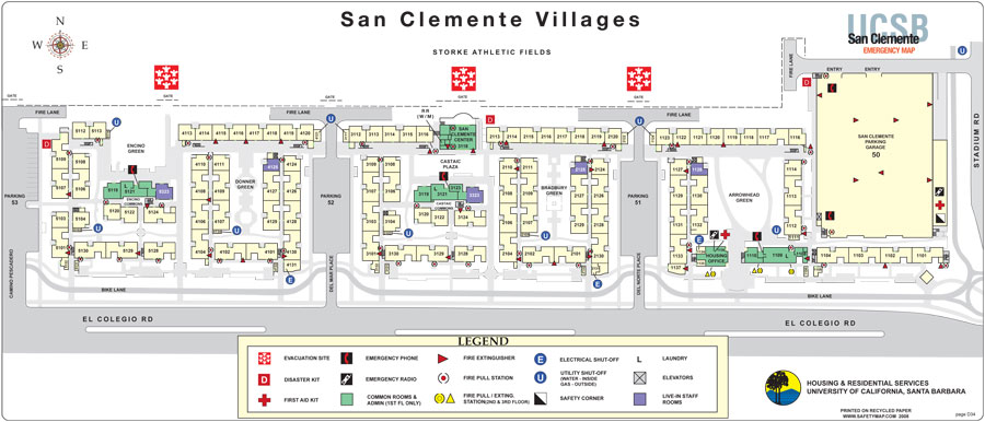
Site MapsSite maps are an essential part of every training manual. They display all buildings and surrounding areas, as well as major exits and routes to evacuation zones. Icons are used to graphically display all potential hazards and response equipment. These maps can be printed in a variety of sizes and are great for use in your lobby or boardroom to show the entire facility to visitors. » Get Estimate |
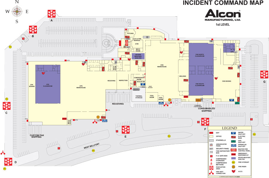
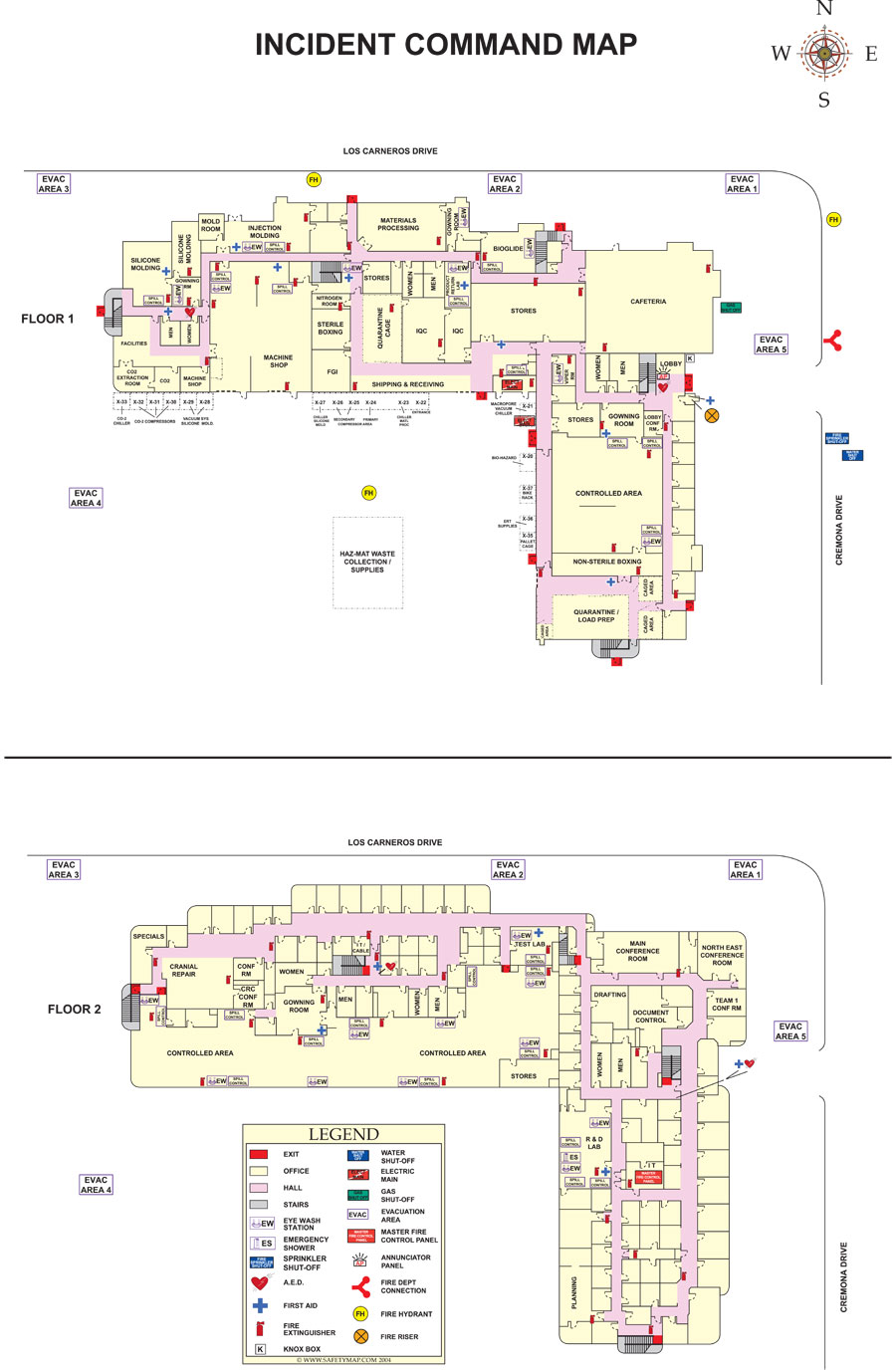
Incident Command MapsThe Incident Command Map is targeted for use in safety training as well as being a valuable tool for emergency responders such as firefighters and police. This large format map (approx. 24 X 36 inch) can be used with grease pens for strategic planning and drills. Great for use in all types of facilities, and is especially helpful in schools where safety is crucial. These maps should be included in your Emergency or Violence Response Kits and stored outside of your facility in a location easily reached by emergency personnel. They reduce the time it takes responders to deal with an emergency by giving them a clear graphic picture of the layout and hazards inside of your facility. These are also available in a smaller laminated format. » Get Estimate |
ERT CardsEmergency Response Team Cards or ERT Cards use a different format to display your site or facility maps. Maps are printed on 5.5" X 8.5" cards with additional instructions on evacuation procedures included. These cards are customized to your specific needs and are used for a variety of purposes including: employee training aids, locator map handouts to visitors of a facility, substitute teacher cards and facility information cards to be handed out to each employee. A great aid in making sure all of your employees understand your evacuation procedures. See outside and inside samples. » Get Estimate |